|
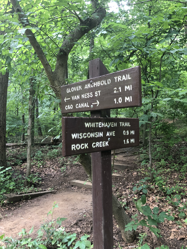
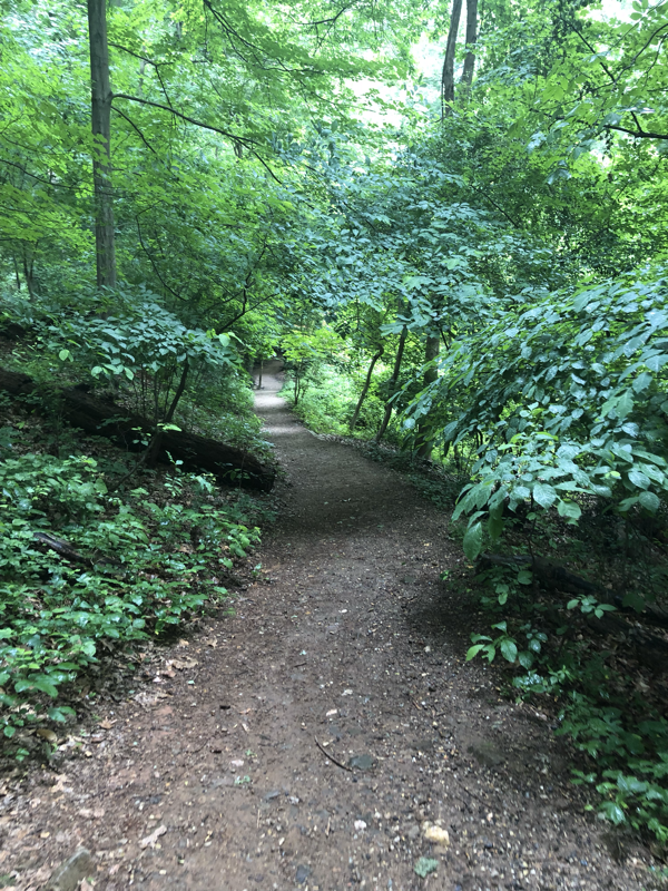
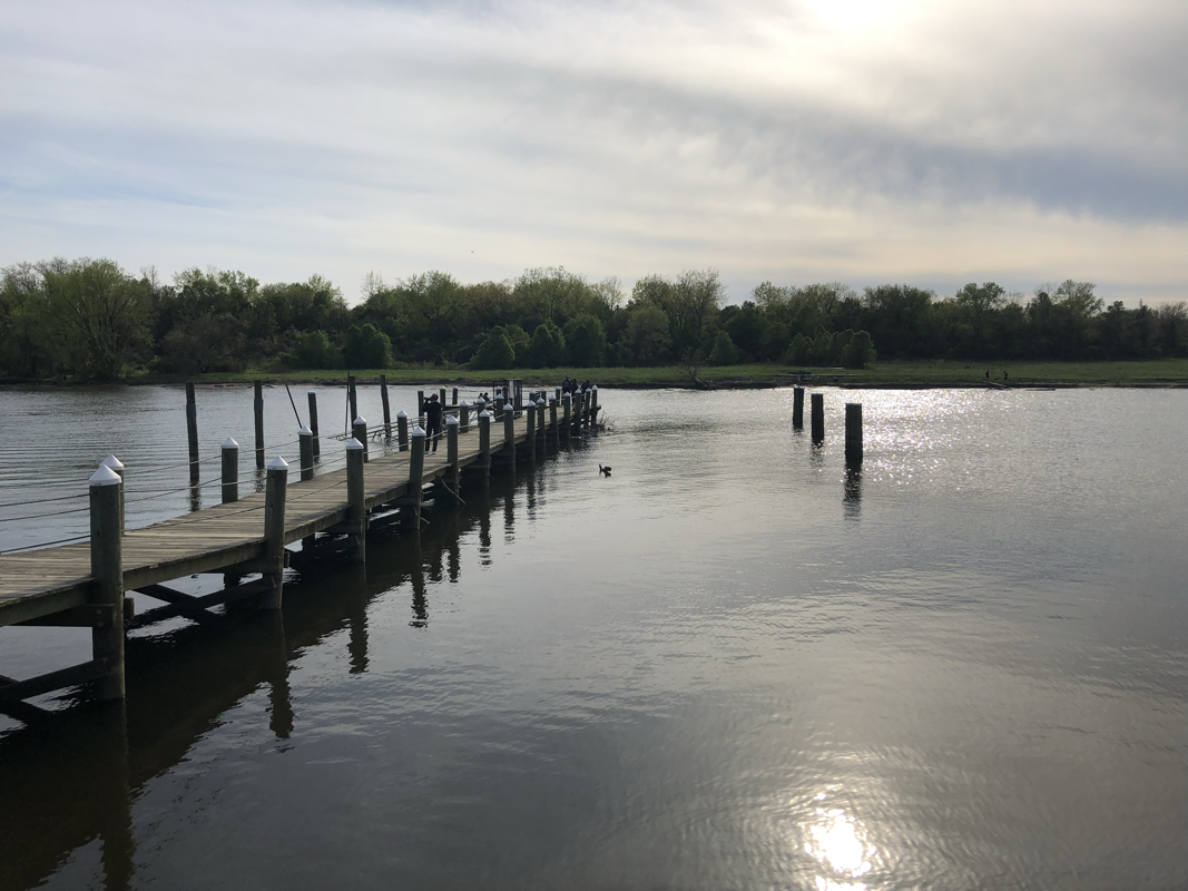
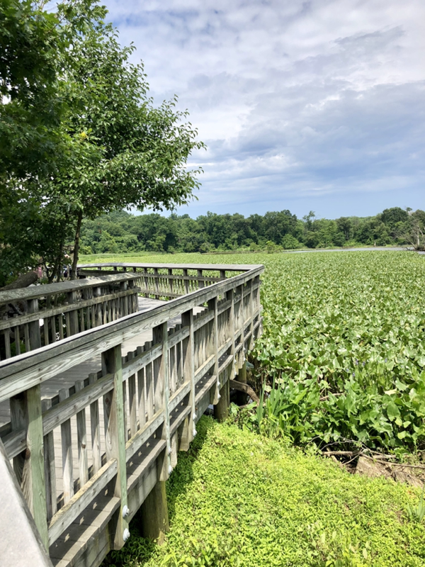
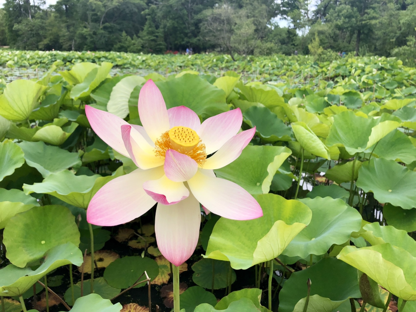
Moving from Portland, Oregon, to Washington, DC, I was afraid that I would miss the mountains and outdoors, so I made it a point to get outside every weekend that I'm in town. There are many parks and natural areas around DC, but most you need a car to get to. I don't have a car so I've made it my mission this year to find places to hike that are accessible by public transit, including the metro, bus, and even streetcar. Here's the list so far and also check out the newly posted 5 more places to go hiking in DC by metro. Rock Creek ParkDefinitely the easiest hiking to get to in the city, Rock Creek Park takes over NW in terms of green space. There's various ways to get there and plenty of trails, I've described my favorite below. How to get there: Take the Metro Red Line towards Shady Grove and get off at the Van Ness-UDC stop. Walk north on Connecticut Ave. and then take a right (head east) on Albemarle St. NW. Shortly will find the Soapstone Valley Park trailhead and you can follow this all the way into Rock Creek Park (about a mile). Takes about 20 minutes from Union Station. Suggested hike: From the Soapstone trail, connect to the Boulder Bridge Hike trail (pink blazes) to take you on a 3.5-mile loop through the park. With the mile-long Soapstone trail and any additional scenic detours you take from the main loop, this can be about a 6-7 mile loop hike total taking about 2.5-3 hours. Glover Archbold Trail and Whitehaven TrailI love that in DC you can be surrounded by buildings and then seemingly disappear into the woods and lose all sounds of the city. The Glover Archbold Trail is just that, connecting the C&O Canal to Rock Creek Park through the Whitehaven Trail. It one of these long green spaces that you look for on a map, but don’t really know what it will entail until you get there. How to get there: This one is a bit tricky. First, make your way to Georgetown, which is not connected by the metro but many bus lines do go through there. Then, you can start on the C&O Canal Trail from the Georgetown waterfront and proceed for about half a mile. You’ll find a (very creepy) tunnel under the road taking you off the C&O Canal. The trailhead for the Glover Archbold Trail is closed here but you can walk through the Georgetown campus behind their main bus stop round about. There is a gap in the fence that leads to the trail. I recommend using Google maps on this one! Suggested hike: From Georgetown, take the Glover Archbold Trail for about a mile north. Then, you can head east on the Whitehaven Trail, passing by a charming community garden and ending north of Georgetown, or continue north on the Glover Archibold Trail throug the park and ending at Van Ness St. in about two miles. Overall, a 2-3 mile hike taking 45 minutes to an hour. Accontik TrailI discovered the Accontik Trail as I was looking for a place to hike near my friend's house in Vienna. It's actually a really long trail through Northern Virginia and good for biking. The part I describe below is easily accessible from public transit. How to get there: Take Metro Orange Line to Vienna and get off at Vienna stop. Take bus 1A towards Ballston and get off at Arlington Blvd & Covington St stop. You will see the paved trailhead right off of the road. Takes about 1 hour from Union Station. Suggested hike: 5-mile out and back loop from Arlington Blvd., takes about 2 hours. Anacostia River Trail and ParkEveryone knows about the bike trails along the Potomac River, but how about try the Anacostia River Trail for a change? There's boardwalks, bridges, and even a few hills along this scenic river route that takes you to the Anacostia River Park in Maryland, with a pier, rowing club, and boxcar to explore. How to get there: Bike east down G St. NE from Union Station (through the H St. corridor) and Benning Rd., you will find the Anacostia River Trail after crossing the Benning Rd. bridge. You could also take the DC Streetcar from Union Station Eastbound to the last stop on Benning Road and similarly cross the bridge on foot. Suggested hike: 3.5 miles one-way from Benning Rd. to Anacostia River Park, takes about an hour walking. This is also a great biking trail. Kenilworth Park and Aquatic GardensDC was built on a swamp and you can really see the remnants of this in the Kenilworth Park and Aquatic Gardens. With boardwalks through marshes and gorgeous flowers growing out of lily pads, I highly recommend going in spring/summer. How to get there: The most direct way to get there is via the Orange/Blue metro line in the direction of New Carrollton and get off at the Deanwood stop, about 30 minutes from Metro Center and then walk 12 minutes (0.6 miles) to the park entrance on the west side of the Anacostia freeway. However, the most fun way to get there is to bike east down G St. NE from Union Station (through the H St. corridor) and Benning Rd. and then north on the Anacostia River Trail, taking about half hour from Union Station. You could also take the DC Streetcar from Union Station Eastbound to the last stop on Benning Road and similarly walk north on the Anacostia River Trail for about 3 miles (1 hour). Suggested hike: There's a maze of dirt paths and trails through the park, so you can make a leisurely walk of about 2-3 miles, approximately one hour, depending on how many times you stop to take pictures of the flowers. Be sure to also check out the newly posted 5 more places to go hiking in DC by metro.
1 Comment
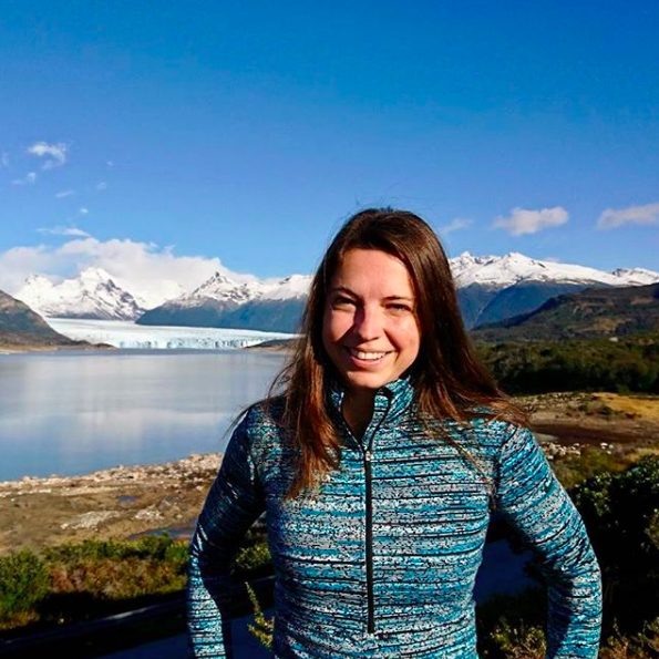
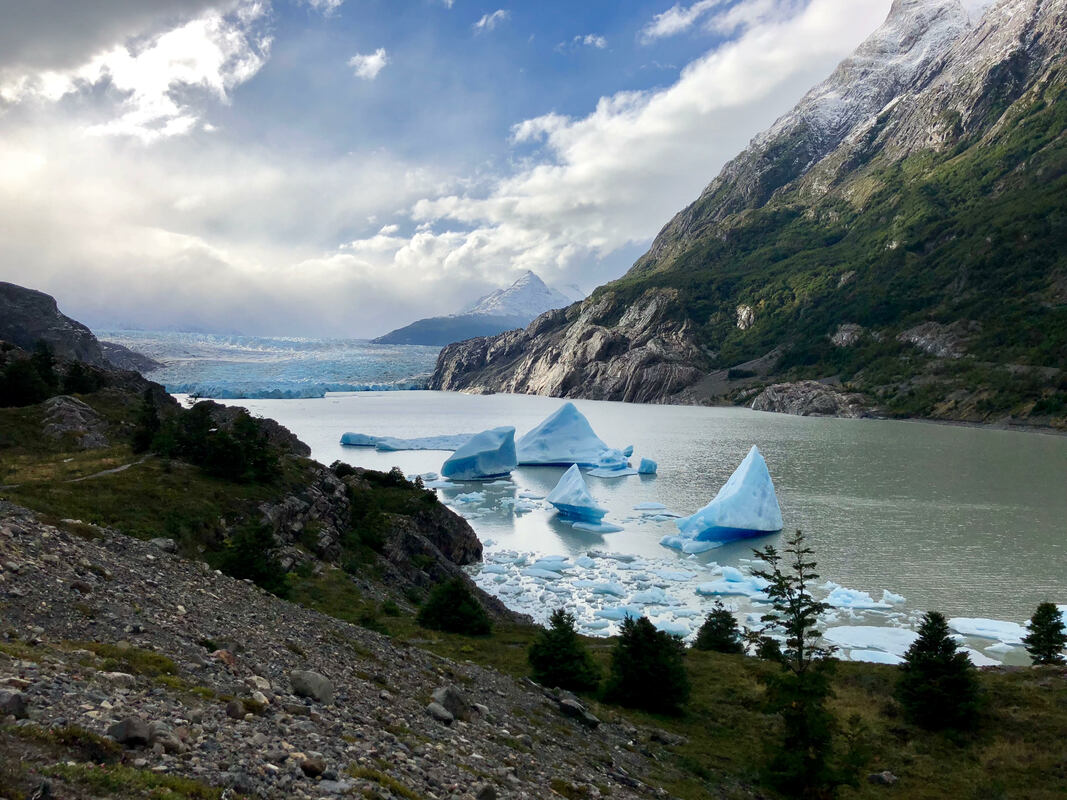 You may have noticed that I haven't written on this blog in a while (since 2015) and that I recently updated this entire website. What inspired this was looking through my iPhone photos, I was trying to find a good picture of nature that I took myself that I could use on my various social media pages. The vast views of nature - whether it be beaches, mountains, or plains - inspire me and motivate me to continue to preserve nature in my work. I came across the picture above that I took nearly a year ago in Patagonia. It shows the massive Grey Glacier leading into Lago de Gray, with majestic mountains in the background, and gray sky forming into painted clouds. It really is a beautiful picture and perfectly captures the magnificence of Torres del Paine National Park in Chile. Beyond beauty, this photo also captures the fragile balance of nature. The icebergs in the foreground are the remnants of a huge chunk of the glacier that broke off a few months before my visit. Just 30 years ago, the glacier still came up all the way to where I am standing taking that picture. See these satellite images of Grey Glacier taken by NASA in 1986. I selfishly thought to myself, I'm glad that I saw this before the glacier recedes even more, and turns into just Lago de Grey. I fully realize that my own travel to these beautiful and far away places contributes to pollution, climate change, and environmental degradation. I reduce my impact in many ways: eating less meat and no dairy; giving up a car and biking/metro-ing instead; shopping less and reusing more (still working on this one!); and of course, working in an industry that provides a significant portion of carbon-free energy. But travel is one thing that I'm not willing to give up. Therefore, the least that I can do is share the things that I learn from traveling, in hopes of inspiring others to live sustainably in the ways that they see fit. The original name of this blog "Living" is still very appropriate, living sustainably, mindfully, and with positive impact. Everyone is living in their own way and I'd like to share my way of living. Welcome back to the blog! I'll leave you with another beautiful picture of Grey Glacier leading into Lago del Grey. 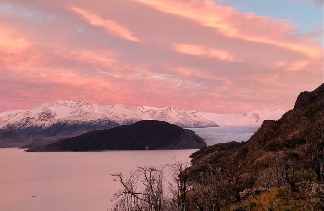 |
Lenka KollarEcomodernist and nuclear engineer inspired by nature. Archives
May 2020
|


 RSS Feed
Photo used under Creative Commons from Artem Beliaikin
